

GIS and Public Sector Mapping
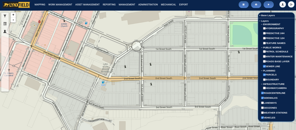
GIS (geographic information system) mapping technology is a powerful tool that is widely used in the public sector to help organizations better understand and manage their geographic data. Lynxfield is a leading provider of GIS mapping technology for the public sector, offering a range of solutions that are specifically designed to meet the unique needs of government agencies and other public sector organizations.
One of the key benefits of Lynxfield GIS mapping technology is its ability to help organizations visualize and analyze their data in a geographic context. This can be particularly useful for public sector organizations that are responsible for managing large and complex datasets, such as those related to infrastructure, land use, and environmental monitoring. By using GIS mapping technology, these organizations can more easily identify patterns and trends, and make informed decisions based on this information.
In addition to its data analysis capabilities, Lynxfield GIS mapping technology also includes a range of tools for managing and sharing data. This includes features such as data integration, which allows organizations to combine data from multiple sources, and data sharing, which enables organizations to share data with other agencies and stakeholders.
